Funded Teaching Innovations

Olympus Vanta M series handheld XRF analyzer
For use in classroom instruction and undergraduate research projects
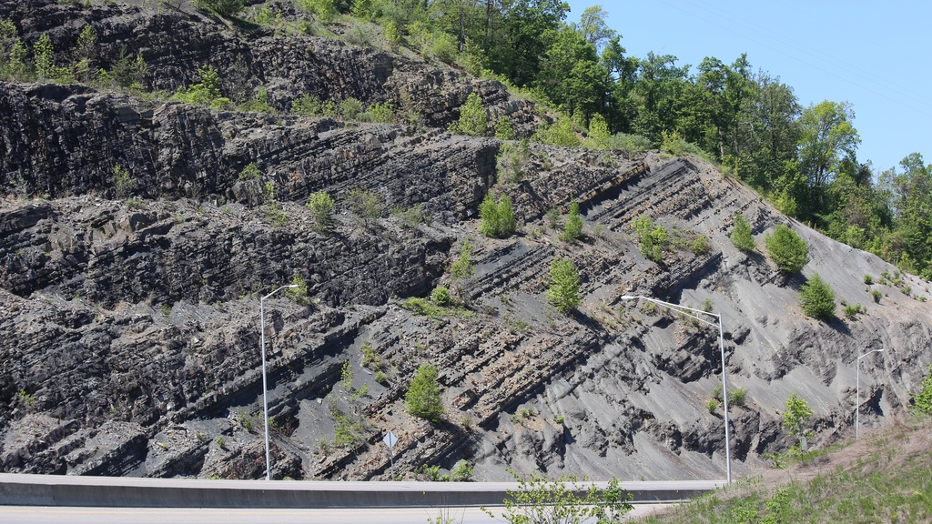
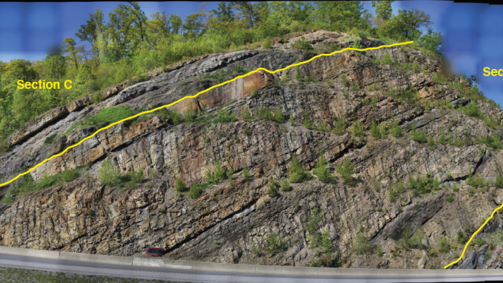
Bringing Field Sedimentology & Stratigraphy to the Classroom
A Virtual Field Trip to the Appalachian Mountains
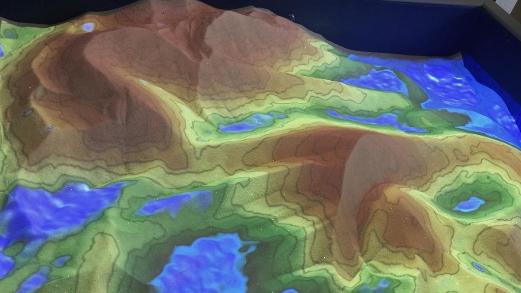
Augmented Reality Sandbox
Shaping landscapes in the classroom
GigaPan and camera equipment
Ultra-high-resolution field photography
Courses
Sedimentary Geology
The primary goals of this course are to provide the student with the knowledge and tools necessary to:
- Interpret the processes that transported and deposited sedimentary rock
- Determine the age and physical extent of sedimentary deposit
- Correlate and make predictions between outcrops or subsurface data
- Infer provenance characteristics, including source rock lithology and location (proximal or distal), and topographic relief
- Create depositional paleoenvironmental and paleogeography maps
- Infer potential petroleum or groundwater system characteristics based on the characteristics of sedimentary deposits
Mineral & Petroleum Exploration Geology
This course covers the fundamentals of resource exploration philosophy and methods, with project-based presentation of techniques and strategies for mineral exploration and petroleum exploration; integration and evaluation of geological, geochemical, and geophysical techniques for mineral exploration; hydrocarbon systems and seismic interpretation for petroleum exploration. A one-week field trip is required.
Tectonics and Basin Analysis
The goal of this course is to cover the fundamentals of global plate tectonics, tectonic processes, and development of orogenic belts. The course focuses on synthesis of data and concepts to understand theoretical and applied aspects of global tectonics and application of tectonic principles to addressing regional geological problems. A one-week field trip is required.
Field Methods and Field Analysis
These two courses combine to constitute our 6-week field camp. Students are introduced to basic principles and techniques of field geology including: learning and constructing stratigraphic sections, measuring planar structures, identifying geologic map units and contacts, and creating surficial and bedrock geologic maps complete with a legend and cross-sections. Emphasis is placed on making fundamental geologic observations. The field work takes place in the Rocky Mountains of southwest Montana.
Structural Geology
Goals:
- To introduce the geometric, kinematic and dynamic aspects of structures in the Earth's crust.
- To understand the basic methods of structural geology, especially techniques that use 2d representations of 3d structures.
Career Path Planning for EES
This course provides an opportunity to cultivate a sense of what employers deem as important skills beyond the technical requirements, develop a set of polished application materials and practice interviewing skills, and investigate a wide variety of potential career paths through interaction with department alumni.
Advanced Structure, Geochronology, and Sedimentology
Co-taught with Dr. Bill McClelland and Dr. Jane Gilotti. The course covers advanced topics in structural geology, U/Pb geochronology, and basin analysis in 3 separate modules.
Geochronologic and Geochemical Applications in Sedimentary Geology
This seminar focuses on the most recent geochemical and geochronologic methods applied to sedimentary rocks. Papers cover both case studies and methods papers. This reading seminar will involve a combination of student-led discussions and presentations.